Visualizing CAV-Ready Cities
Talk of connected and automated vehicles (CAVs) is all around us—in the media, in personal conversations, and in academic and professional circles.
But what might a CAV-adapted streetscape look like? How comfortable and safe will non-motorized travelers and other road users find that physical environment? This is one question addressed by TSAP project 1: “Impact of CAV-ready infrastructure on vulnerable road users: Guidance for North Carolina’s local and state transportation agencies.”
The research team has developed a protocol for visualizing existing intersections to illustrate their current configuration and features, then apply select promising accommodations for CAVs to these visual renderings to convey a sense of a future with CAVs in the travel landscape. These visualizations may be used to inform and support public discussion, surveys, and expert interviews.

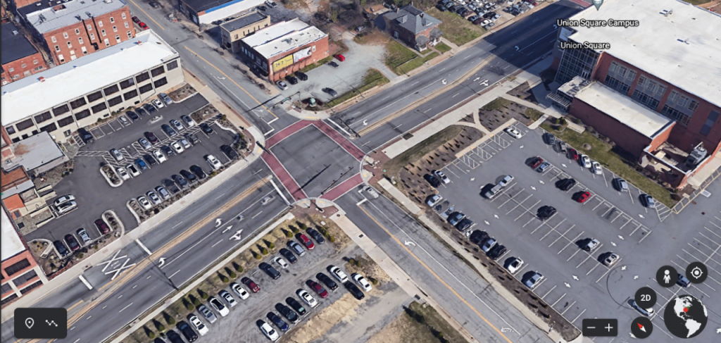
Image 1 is a current photo of the intersection of Gate City and Elm in Greensboro, North Carolina—an urban environment with moderate auto traffic and some pedestrian features.

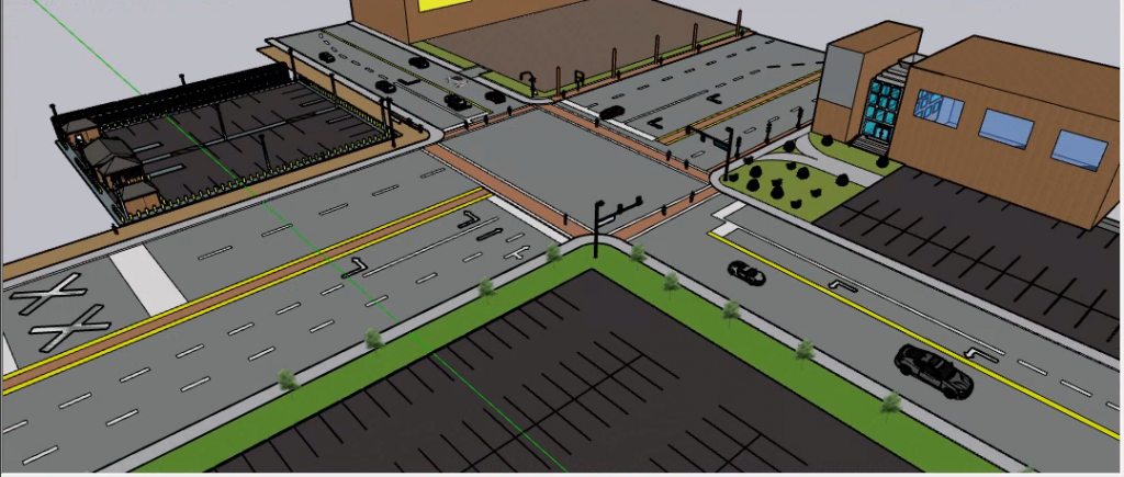
Image 2 shows the current configuration of that same intersection rendered in SketchUp—a 3D environment with zoom and pan features.

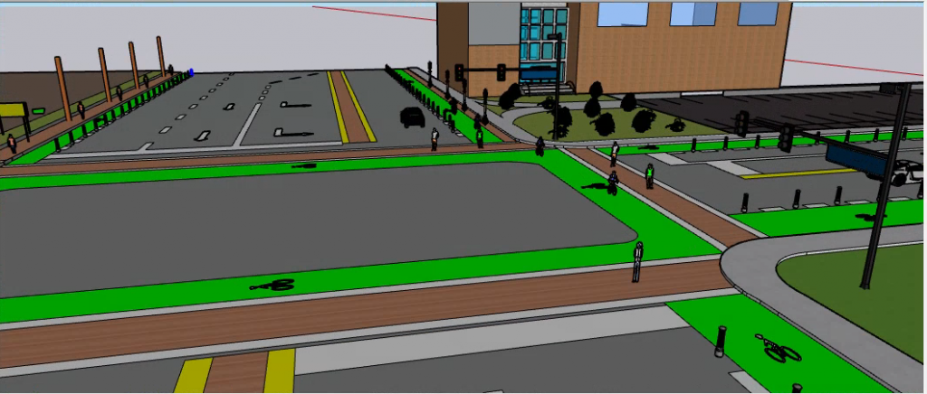
Image 3 shows the same intersection with a select set of accommodations for CAVs. They were chosen from a set of possible alterations such as reducing vehicular right-of-way and reallocating it to protected bicycle and pedestrian features, reconfiguring intersection design with through and turn lanes, curb design that maintains multimodal efficiency, and current parking capacity converted to a mix of features—parking (all vehicle types), dropoff/pickup and delivery sites, and ride-hailing facilities, as well as active uses such as seating, water and vegetated features, art, food services, and more. Incremental and reversible alterations allow piloting and testing of new treatments—and for the traveling public to ‘vote with their feet’ and their dollars in making a built environment lively and loved.
The team chose an off-the-shelf package (SketchUp) that represents a convergence of availability, ease of use, and realistic output, which a transportation planner or urban advocate might be comfortable learning and using. The project focuses on six intersections in three municipalities (Boone, Greensboro, Charlotte) for some regional variation as well as differences in urban character and land use.

Appalachian State University senior Nick Webster used SketchUp to ‘render’ the configuration and features of each intersection, then illustrated future CAV-adapted intersections with select physical changes rooted in both the literature and our preliminary findings from dozens of interviews with subject experts, conducted in 2020 as part of this project.
